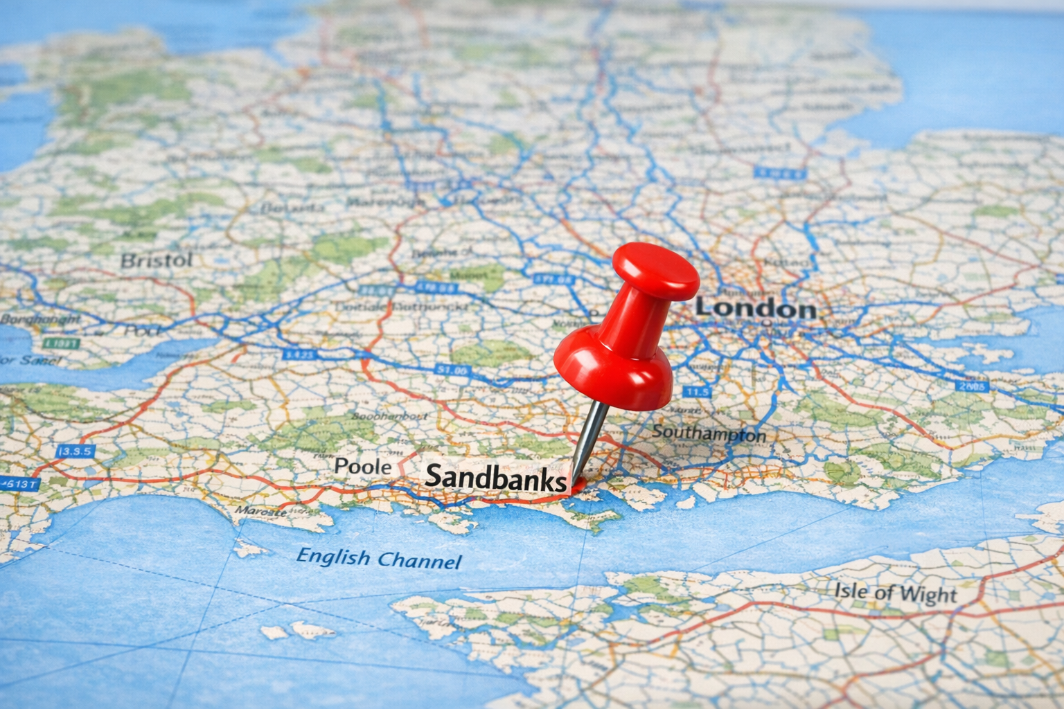
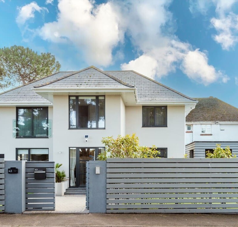
Sandbanks is a spectacular small peninsula located on the South Coast of England, nestled within the ceremonial county of Dorset. Famous globally for its golden Blue Flag sands and luxury real estate, it sits directly across the mouth of Poole Harbour, perfectly positioned between the coastal resort towns of Poole and Bournemouth.
The Geography of the Peninsula
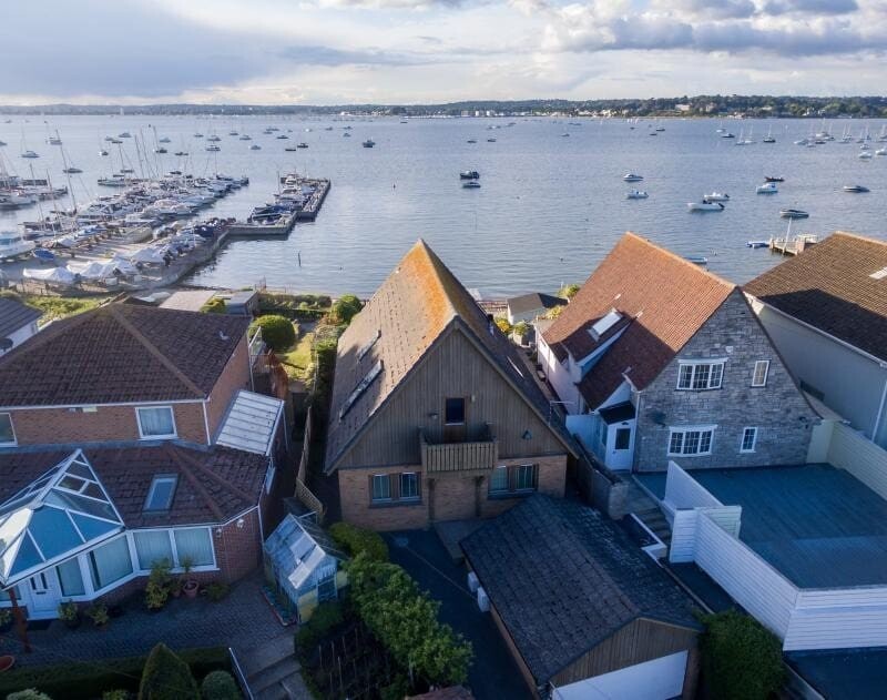
While it is world-renowned, Sandbanks is actually surprisingly small. Covering an area of roughly one square kilometre, the sandy spit acts as a natural barrier enclosing Poole Harbour—the second-largest natural harbour in the world. To the east of Sandbanks lies the open English Channel and Bournemouth Bay, while to the west lie the sheltered, shallow waters of the harbour.
At the very tip of the peninsula, a chain ferry connects Sandbanks to Studland and the Purbeck Hills. This acts as a vital, scenic gateway to the world-famous Jurassic Coast, a 95-mile stretch of UNESCO World Heritage coastline.
While it is famous globally for its staggering property prices, Sandbanks itself is actually surprisingly small. The entire peninsula is roughly 1 square kilometer in size.
Geographically, it acts as a sandy spit that crosses the mouth of Poole Harbour—the second-largest natural harbour in the world. To the east of Sandbanks lies the English Channel and the sweeping curve of Bournemouth Bay. To the west lies the sheltered, shallow waters of the harbour.
At the very tip of the peninsula, a chain ferry connects Sandbanks to Studland and the Purbeck Hills. This acts as a vital gateway to the world-famous Jurassic Coast, a 95-mile stretch of UNESCO World Heritage coastline.
DISTANCES FROM MAJOR CITIES
Because of its location on the central south coast, Sandbanks is incredibly accessible from major UK hubs, making it a highly popular weekend retreat.
-
From London: Approximately 110 miles (a 2.5-hour drive via the M3 and M27, or a direct 2-hour train from London Waterloo to nearby Poole).
-
From Southampton: Approximately 35 miles (a 50-minute drive).
-
From Bristol: Approximately 75 miles (a 2-hour drive).
Driving to the Coast: Popular Routes
Because of its prime location on the central south coast, Sandbanks is incredibly accessible from major UK hubs, making it a highly popular weekend retreat. Here are the most common driving routes:
From London & The South East (Approx. 2.5 Hours)
The most direct route from London takes you out via the M3, joining the M27 westbound through the scenic New Forest, and finally onto the A31 towards Poole.
From Birmingham & The Midlands (Approx. 3.5 Hours)
If you are travelling down from the Midlands, the most straightforward route heads south down the A34 towards Winchester, before joining the M27 and A31 into Dorset.
From Bristol & The West (Approx. 2 Hours)
Travelling from the West Country? The drive takes you through the beautiful rolling Dorset countryside, typically following the A350 or A35 straight down into Poole town centre.
Plan Your Arrival
Depending on how you are travelling, we have created dedicated insider guides to make your arrival on the peninsula as smooth and stress-free as possible.


Is Sandbanks in Poole or Bournemouth?
This is a very common point of confusion for first-time visitors! Technically and administratively, Sandbanks is part of Poole. It has a Poole postcode (BH13) and sits at the entrance to Poole Harbour.
However, because the Sandbanks beach connects seamlessly to Bournemouth’s famous seven-mile stretch of golden sand, many tourists naturally associate it with the Bournemouth resort area. Today, the entire region is governed by a single combined authority: the BCP (Bournemouth, Christchurch, and Poole) Council.
Local Tip: If you are booking train tickets, arriving at Poole Station puts you geographically closer to the peninsula, though Bournemouth Station is only a few miles further away and offers excellent bus connections!
Frequently Asked Questions
Is it easy to get around Sandbanks without a car?
Absolutely. The peninsula is incredibly compact and very easy to navigate on foot or by bicycle. The Purbeck Breezer bus (Route 50) also runs directly onto the peninsula from Bournemouth and Poole, making car-free travel highly accessible.
Where is the best place to park in Sandbanks?
The main Sandbanks Surface Car Park (BH13 8QJ) is located right next to the beach, but it fills up very quickly during the summer months. For a stress-free trip, we recommend reading our dedicated Sandbanks Parking Guide or considering public transport options like the Purbeck Breezer open-top bus.
Can I get a ferry to Sandbanks?
Yes. A chain ferry operates across the mouth of Poole Harbour, connecting Sandbanks to Studland and the Isle of Purbeck. This provides a scenic and direct route if you are travelling from the west or exploring the Jurassic Coast.
How far is Sandbanks from London?
Sandbanks is approximately 110 miles from central London. It is a roughly 2.5-hour drive via the M3 and M27 motorways, or a direct 2-hour train journey from London Waterloo to nearby Poole Station.
Is Sandbanks in Poole or Bournemouth?
Technically and administratively, Sandbanks is part of Poole (which is now governed by the BCP Council). However, because the beach connects seamlessly to Bournemouth’s seven miles of sand, many tourists associate it with the Bournemouth resort area. If you are travelling by train, Poole Station puts you closer to the peninsula.